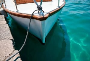
Maritime navigation is a activity that requires constant attention and specific knowledge for ensure the safety of vessels and their crewsA fundamental part of this security is the correct identification of maritime traffic signals, which allow traffic to be regulated, accidents to be avoided and the environment to be protected. In Anclademia, we will explain the main signals that every navigator should know, their meanings and how to interpret them correctly.
What are maritime traffic signals?
The maritime traffic signals are symbols, marks or lights used to guide ships during navigationThey function like land traffic signs, but adapted to the aquatic environment, and serve to indicate safe routes, restricted areas, hazards or reference points. These signs may be present in buoys, beacons, lighthouses or directly on boats.
Classification of maritime signals
Maritime traffic signals are classified into different categories according to their function:
- Side navigation signals: They indicate the boundaries of navigable channels and safe navigation zones. Buoys with specific colors and shapes are used to mark these boundaries.
- Cardinal signs: They provide information on safe directions to avoid danger, using a combination of colors and shapes that indicate the cardinal direction in which to navigate.
- Isolated danger signs: They mark a specific obstacle or hazard in the water, which could be a reef, a rock, or a shipwreck.
- Signs of safe waters: They indicate areas where navigation is safe and there are no immediate dangers.
- Special signs: They provide information on areas with restrictions or specific activities, such as anchorage areas, fishing areas, or environmentally protected areas.
Lateral navigation signals: red and green
These are probably the most well-known and used signals in maritime traffic. They are based on a buoy and beacon system that delimit the navigation channel:
- Red buoy: It marks the right (starboard) side of the channel when entering the port from the sea. They are generally conical in shape.
- Green buoy: It marks the left side (port) of the channel in the same situation and is usually cylindrical or inverted conical in shape.
The general rule for following the channel is: “red to starboard” when entering the port. This means that the red buoy must be on the right of the boat. Instead, When leaving the port, the rule is reversed.
Cardinal signs: safety by orientation
Cardinal signs indicate in which direction to sail to avoid an approaching danger. They are divided into four types:
- North Cardinal: Indicates that danger is to the south and safe navigation is to the north. The buoy has two black cones pointing upward and rapidly flashing lights.
- Cardinal East: It signals that the danger is to the west and that you should navigate east. The cones are placed, one pointing up and one pointing down, with flashing lights in groups of three.
- Cardinal Sur: Indicates that the danger zone is to the north and the safe zone is to the south. The cones point downward and the lights flash in groups of six, with a prolonged flash.
- Cardinal West: It signals that danger is to the east and safe navigation is west. The cones are one down and one up, and the lights flash in groups of nine.
These signs They help navigators know exactly where to go to avoid obstacles., especially in areas with poor visibility or at night.
Isolated danger signs
These buoys mark a specific danger in the water, such as rocks, shipwrecks or areas with dangerous currents. They have a cylindrical shape with horizontal black and red stripes and two black cones. at the top qthat point one up and one down. They are important to alert vessels and avoid serious accidents.
Signs of safe waters
They indicate areas where there are no immediate dangers and it is safe to navigate. These buoys are generally spherical and have vertical red and white stripesThey are also used to mark entry points or authorized anchoring areas.
Special signs
In the maritime field there are areas with special regulations that require specific signals. For example:
- Anchoring areas: Marked with yellow buoys or a beacon signal with flashing yellow lights.
- Fishing areas: Indicated with signs that alert mariners to reduce speed or avoid the area.
- Protected areas: Designated to protect the fauna, flora and marine ecosystem, where navigation or certain activities are restricted.
Training and practice
Correctly identify maritime traffic signals It is not only a question of theoretical knowledge, but also of practical experience. That's why, navigation courses and the practices at sea are fundamentals so that future sailors can operate safely and confidently.
Correct interpretation of maritime traffic signals is key to safety at sea. Recognizing buoys, beacons, and other indicators allows boaters to avoid hazards, comply with regulations, and protect the marine environment. Whether you boat recreationally or professionally, knowing these signs is essential to ensuring safe and responsible boating.